


Associated People (4) |
|
The dates listed below have different categories as denoted by the letters in the brackets following each date. Here is a key to explain those letter codes:
|
|
1820 [EA] - 1826 [LA] → Owner
|
|
1829 [EA] - 1834 [LA] → Executor
|
|
1829 [EA] - 1832 [LA] → Previous owner
|
|
1829 [EA] - → Agent
|
Associated Claims (1) |
|
£546 19S 10D
|
Estate Information (8) |
|
1763
[Name] Lot 7
[Size] 17 [Crop] coffee In 1763, the estate was 17 acres, of which 12 was under cultivation. The estate was growing coffee. Proprietor given as Richou.
'A topographical description of the Island of Grenada; surveyed by Monsieur Pinel in 1763... with the addition of English names, alterations of property, and other improvements to the present time' (1780), British Library Maps K. Top.123.112.b-e
|
|
1782
[Name] Lot 7
[Size] 54 [Crop] coffee or cocoa In 1780-1782, the estate comprised 54 acres, growing coffee or cocoa. No proprietor's name given.
'A topographical description of the Island of Grenada; surveyed by Monsieur Pinel in 1763... with the addition of English names, alterations of property, and other improvements to the present time' (1780), British Library Maps K. Top.123.112.b-e
|
|
1820
[Number of enslaved people] 15(Tot) 6(F) 9(M)
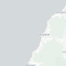
[Name] Esperance Estate Belonging to or in the lawful possession of Robert Ferguson, position not recorded.
T71/274 33
|
|
1823
[Number of enslaved people] 16(Tot) 7(F) 9(M)
[Name] [no name given] Belonging to or in the lawful possession of Robert Ferguson as Proprietor.
T71/285 61-62
|
|
1824
[Size] 54
[Crop] Provisions Plotted on Gavin Smith's 1801 map of Grenada as Estate 6 in St Mark, corresponding with Lot 7 in St Mark on Paterson's 1780 map. Produce given as provisions, 54 acres, proprietor R. Ferguson.
'Reference to the plan of the Island of Grenada by Gavin Smith showing the names of all the different estates; the proprietors' names (corrected up to 1824); the species of produce made; and the quantity of land belonging to each' (London, 1882) p. 6.
|
|
1826
[Number of enslaved people] 20(Tot) 9(F) 11(M)
[Name] L'Esperance Estate Belonging to Robert Ferguson and attached to L'Esperance Estate.
T71/299 40-41
|
|
1829
[Number of enslaved people] 20(Tot) 10(F) 10(M)
[Name] L'Esperance Estate Belonging to or in the lawful possession of Thomas Ed Lord as Agent for John Ferguson the Exor of the late Proprietor, Robert Ferguson decd
T71/311 150-151
|
|
1832
[Number of enslaved people] 20(Tot) 10(F) 10(M)
[Name] L'Esperance Estate The property of the late Robert Ferguson deceased by John Ferguson Executor.
T71/317 122
|
???? - 1848
Successful planter in British Guiana and Grenada; part of a close-knit mixed-race family with numerous business interests.

Document comprises 4 parts, written recto and verso across 5 folios: 1. An inventory and valuation of enslaved persons at Windsor Estate, St Elizabeth parish, Jamaica, 1814. 2. An inventory and valuation of enslaved persons at Williamsfield settlement, St Elisabeth parish, Jamaica, 1814. 3. An inventory of animals at Windsor Estate, St Elizabeth parish, Jamaica, 1814. 4. A cover note outlining the contents of the document.
© Copyright Legacies of British Slavery - UCL Department of History 2025
CITING THIS RECORD:
'L'Esperance [ Grenada ]', Legacies of British Slavery database, http://wwwdepts-live.ucl.ac.uk/lbs/estate/view/1342 [accessed 26th April 2025].
