

Associated People (5) |
|
The dates listed below have different categories as denoted by the letters in the brackets following each date. Here is a key to explain those letter codes:
|
|
1766 [SY] - 1819 [EY] → Owner
|
|
- 16/08/1766 [ED] → Owner
|
|
1819 [SY] - 1834 [LA] → Owner
|
|
1817 [EA] - 1829 [LA] → Attorney
|
|
1832 [EA] - 1834 [LA] → Attorney
|
Associated Claims (1) |
|
£3,825 10S 6D
|
Notes |
|
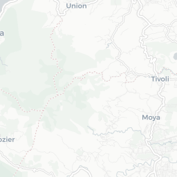
An estate in Grenada in the quartier des Sauteurs and the parish of St. Patrick, identified as lot 34 in Daniel Paterson's Topographical Description of the Island of Grenada (1780). Original copies of documents relating to the estate, including its earlier history and its purchase by Sir George Amyand in the Grenada Plantation Records collection at the Schomburg Center for Research in Black Culture, Manuscripts, Archives and Rare Books Division have been digitised at https://grenadanationalarchives.wordpress.com/2015/09/09/grenada-heritage-plantation-records-1737-1845-in-detail/ |
Estate Information (8) |
|
1763
[Name] [no name given]
[Size] 82 [Crop] sugar In 1763, the estate was 82 acres, of which 45 was under cultivation. The estate was growing sugarcane. Proprietor given as La Taste (which became the name of the estate).
'A topographical description of the Island of Grenada; surveyed by Monsieur Pinel in 1763... with the addition of English names, alterations of property, and other improvements to the present time' (1780), British Library Maps K. Top.123.112.b-e
|
|
1782
[Name] [no name given]
[Size] 262 [Crop] sugar In 1780-1782, the estate comprised 262 acres, cultivating sugarcane with a cattle mill. Proprietor given as Sir _______ Amyand, Bart.
'A topographical description of the Island of Grenada; surveyed by Monsieur Pinel in 1763... with the addition of English names, alterations of property, and other improvements to the present time' (1780), British Library Maps K. Top.123.112.b-e
|
|
1817
[Number of enslaved people] 154(Tot)
[Name] Lataste Estate In the lawful possession of Andrew Houstoun as attorney to Sir George Cornewall Bart.
T71/265 357-360
|
|
1820
[Number of enslaved people] 127(Tot) 72(F) 55(M)
[Name] Lataste Estate Belonging to or in the lawful possession of Andrew Houstoun as Attorney for Sir Geo Cornewall.
T71/274 135-136
|
|
1823
[Number of enslaved people] 152(Tot) 82(F) 70(M)
[Name] Lataste Estate Belonging to or in the lawful possession of Andrew Houstoun as Attorney for Sir George Cornewall, Bart.
T71/285 99-100
|
|
1826
[Number of enslaved people] 144(Tot) 76(F) 68(M)
[Name] Lataste Estate In the lawful possession of Andrew Houstoun as attorney for Sir George Cornewall Bart proprietor.
T71/299 119-120
|
|
1829
[Number of enslaved people] 167(Tot) 86(F) 81(M)
[Name] Lataste Estate Belonging to or in the lawful possession of Andrew Houstoun as Attorney.
T71/311 181-182
|
|
1832
[Number of enslaved people] 145(Tot) 79(F) 66(M)
[Name] Lataste Estate Belonging and attached to Lataste Estate the property of Sir George Cornwall Baronet and in the possession of Murdoch Campbell Mitchell Esquire.
T71/317 185-186
|