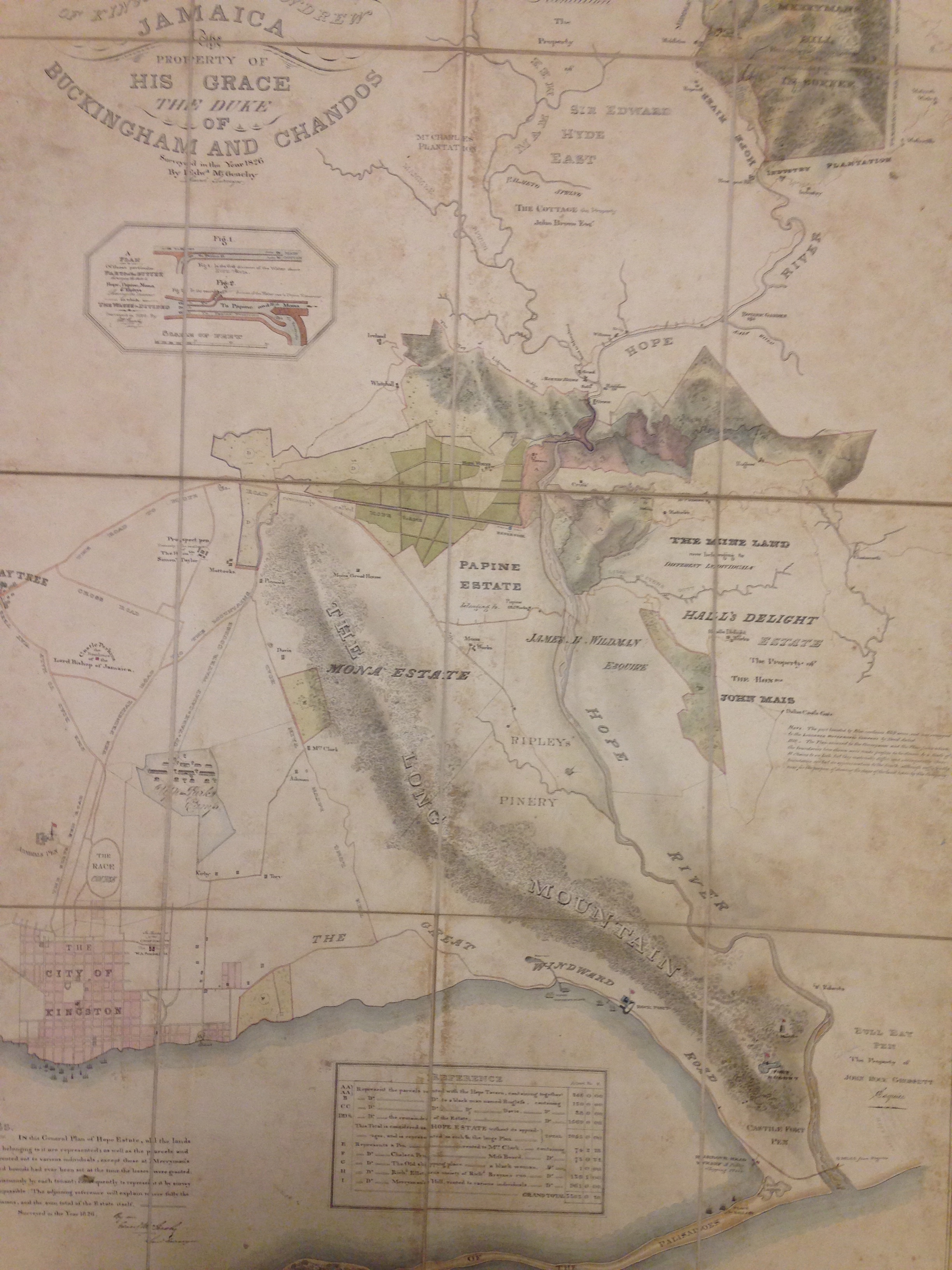
Map of Hope estate in 1826 with outline of canefields. Also shows Mount Charles, The Cottage, Mona, Papine, Hall's Delight and Ireland.
Source: 'New and General Plan of the Hope Estate in the Parishses of Kingston and St Andrew, Jamaica, the Property of His Grace The Duke of Buckingham and Chandos Surveyed in the Year 1826 by Edwd. McGenchy', West Indies Box 1, Stowe Papers, The Huntington Library, San Marino, California.
Hope Estate [ Jamaica | St Andrew ]
Mona Estate [ Jamaica | St Andrew ]
Papine [ Jamaica | St Andrew ]
The Cottage [ Jamaica | St Andrew ]
Ireland [ Jamaica | St Andrew ]
Hall's Delight [ Jamaica | Port Royal ]
Mount Charles [ Jamaica | Port Royal ]
27th Nov 1782 - 8th Dec 1862
Wesleyan Minister, apparently sought to manumit his enslaved people for religious reasons

Document comprises 4 parts, written recto and verso across 5 folios: 1. An inventory and valuation of enslaved persons at Windsor Estate, St Elizabeth parish, Jamaica, 1814. 2. An inventory and valuation of enslaved persons at Williamsfield settlement, St Elisabeth parish, Jamaica, 1814. 3. An inventory of animals at Windsor Estate, St Elizabeth parish, Jamaica, 1814. 4. A cover note outlining the contents of the document.
